November 08, 2023
Hike
•PCT
•Adventure
•Travel
•Rad People
The Pacific Crest Trail—the mother of all west coast trails. It’s long-distance permit application season over at PCTA.org, where intrepid souls are met with the hopeful greeting, “Welcome PCT class of 2024!” We recently connected with an old friend and newly minted member of the class of 2023, Scott Gravatt. We were more than happy to provide a warm bed, a hot burger and cold beers during an unexpected stop along his 2,650 mile journey, in exchange for a good ‘ol PCT story. Enjoy the craziness of a PCT’er.

It was a dark, wet, misty, late August afternoon in the wilderness north of Mt Rainier National Park.
Ya, I could describe the soft moss on the trail, the musty smell of the undergrowth and the towering firs in some kind of fancy John Muir type verbiage, but suffice it to say, when you close your eyes and think about what early fall in the Cascades looks and feels like, you’ve got this.
I was standing at a fork in the path marked “Bullion Basin” located exactly at mile 2333.8 on the Pacific Crest Trail. Checking my map, I noticed that a few miles down was Crystal Mountain Resort, complete with the legendary Snorting Elk Bar inside the Alpine Inn (soon to be renovated and opened this winter as LOGE Crystal Slopeside).
When I say “down” I mean “dooowwwwnn”. Down as in 1,900 feet below me. That’s a considerable elevation drop. At this point I had been hiking over 100 days, making me semi proficient at it, and there emerged about a dozen basic personal rules that I was willing to fight to the death over.
For example, Rule number 9: If there is a big body of water at camp, get in it.-
And, Rule number 6: Walk ten miles before 10am.
Most important to this particular situation was rule number 2: Don’t give up elevation.

Back in the California mountains of the Sierra Nevada I had learned the hard way that once you walk down something, you’ve got to come back up. So, stay as high as possible. Always. Don’t give up the elevation that you worked so hard to gain. It’s never worth it. So, that being said, 1,900 feet was obviously an unacceptable decline.
But that was rule number 2.
This is a good time to introduce you to rule number 1: The hamburger is always worth it.
It had been a few days since I’d seen another person. Everything I owned was wet. I had walked over 2500 miles. I was exhausted. I was nursing a broken rib, standing at the fork in the trail with two opposing principles battling it out in my mind. But maybe most importantly, I was hungry.
[Record scratch]. Ok, so let’s back up. You’re probably wondering how I got here.

Over a decade ago I made the move over the Rockies to Oregon. Coming from Miami, Florida was, to put it mildly, a culture shock in all of the best ways. Growing up in Florida my elementary school book reports were all on subjects like: The Everglades, Hurricanes, or Alligators. By mid-life, I had found myself in Oregon. Ground Zero for all things “West”.
Oregon was the first Western American Outpost and being the insatiably curious person that I am, I now found at my disposal a treasure trove of new subjects: salmon, Mormons, mountains! The Oregon Trail, cowboys, land use rights, wildland firefighting. You name it and I was about it.
In the winter of 2022, I found myself looking in the rearview of a 15-year career at Nike. I could have jumped into the next job within a few days, but I saw the time off as a gift, and I had saved a few bucks along the way. I was looking for a summer of adventure before I made the choice as to what the next phase of my life was going to look like.
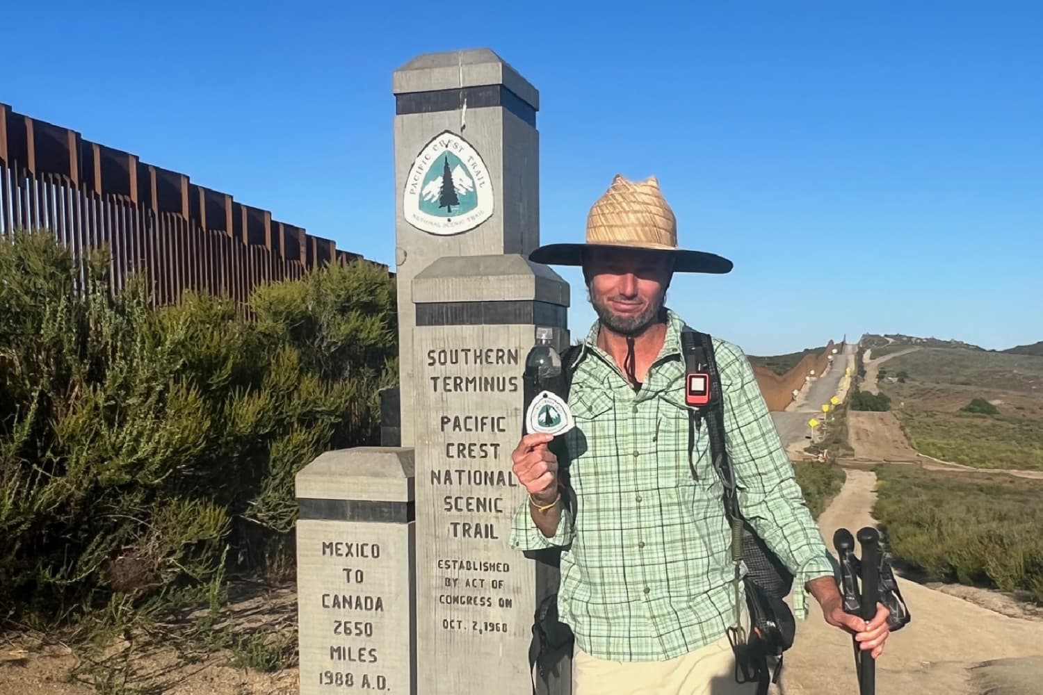
What better way to dive into all of my interest in the Modern American West than to walk the whole thing from South to North through the wilderness on The Pacific Crest Trail. I applied for a PCT permit in November, was approved in December and was set to start my journey in mid-May 2022.

I can confirm that if you start walking Northbound on that 18-inch-wide stretch of trail that begins at the border wall in Campo, California you can eventually end up in Canada. There is a story about how this was developed and how it all came to be, but that’s for another day. For now, just trust me. Head North.
The PCT walks 2,650 miles through the wilderness touching both borders of Mexico and Canada. Heading North from the Mexican border if you walk 700 miles through both Southern California deserts, you will end up at the small horse camp known as Kennedy Meadows South that serves as a southern Base Camp to the Sierra.
Heading out of KMS, you’ll then have to walk over 300 miles through the Southern Sierra Mountain range, in altitude and over the crests of a dozen mountain passes (Forrester Pass is almost 14,000 feet tall) before landing south of Yosemite and heading towards South Lake Tahoe.
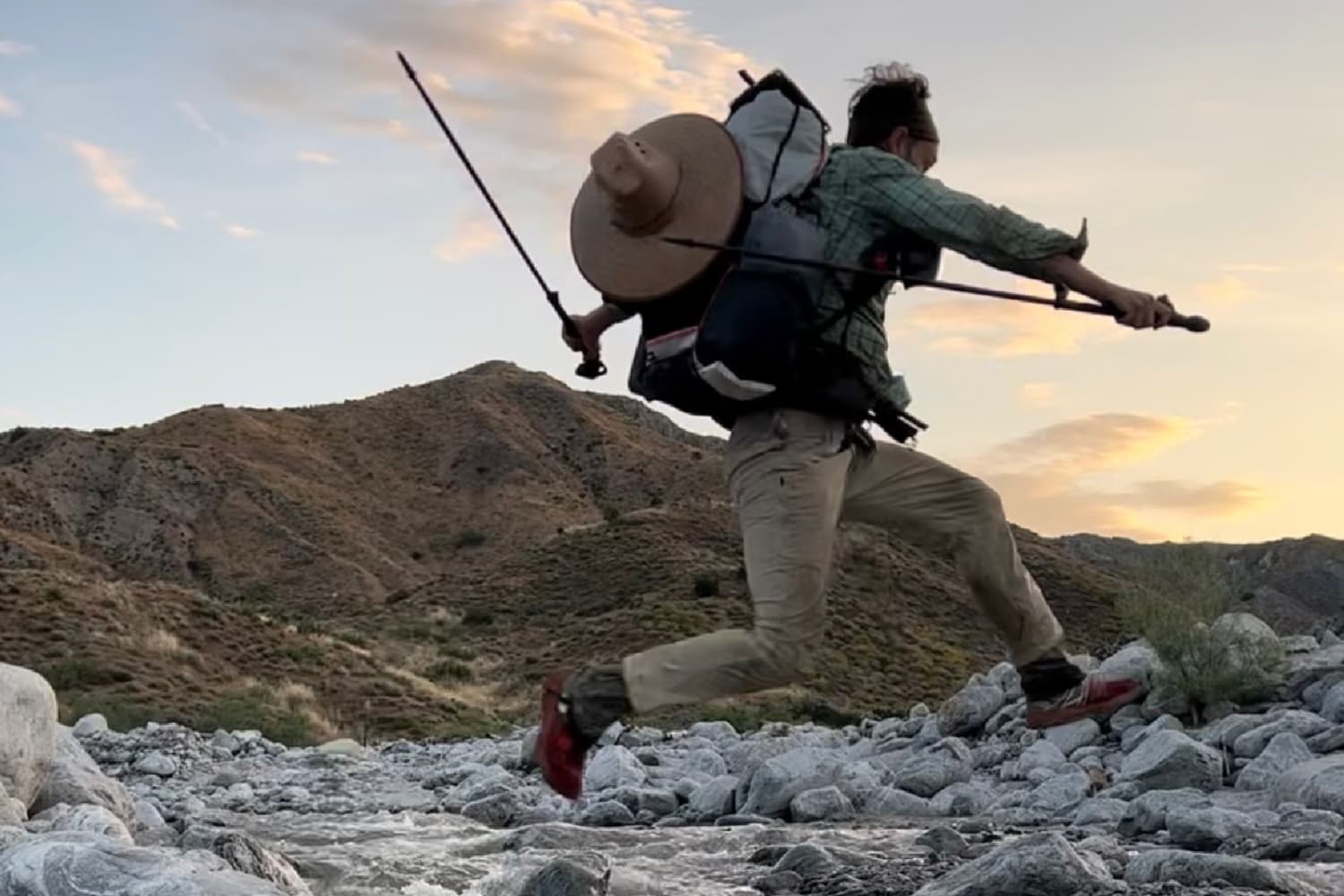
In 2023 the snowpack in that famed Sierra section was at record levels, so for me this included over a month of sleeping on snow, 2am wake up alarms, hiking in crampons with an ice axe in hand until the early afternoon, (when I started post holing up to my crotch, only to finally make camp, try to get some sleep and then do it all over again at 2am).
For an entire month.

When I ran out of food, I turned east off the PCT on unmarked paths (sometimes no path at all) and headed 15 or 20 miles over a mountain pass into one of the small towns in the Owens Valley. After some resupply, I would then dutifully march back over that same pass to the exact same spot at the PCT that I left to start again.
If you ever need a coffee shop or hostel in Lone Pine, Bishop, Mammoth, or anywhere on that 395-mile corridor, hit me up. I’ve got the intel.
After that, you’ve still got hundreds of miles through Northern California, around Shasta and over the Cascade Rrange of central Oregon. The next time you’re driving from Hood to Bend heading South on 97 through Madras, look west towards the Three Sisters. I walked over the top of that entire range.
All that to say, by the time I had arrived at the Bullion Basin trail that heads down into the Crystal Mountain Resort, I was haggard, worn down, and hungry.
The PCT traverses mountain ranges, so not surprisingly it passes very close (sometimes even directly through) ski resorts. Some big ones like Palisades, and Heavenly. When you arrive at Mt Hood, the PCT walks directly over “Pucci,” one of the main Timberline active summertime ski runs. You have to actually look both ways to avoid the skiers on the glacier.
But those are the large resorts. Most of the small resorts you walk over are either fully closed or barely operational during mid-summer.

Thus, the stakes were high standing at the crossroads of Bullion Basin and The Pacific Crest Trail. If I were to jump off the PCT and walk down those 3 kilometers to find a ghost town, not only would it be a gigantic disappointment, it would be a half day wasted, and a lot of energy expended just to turn around and walk back up to continue my “unbroken footpath” to Canada.
Acquiescing to rule number 1, I started the few miles down Bullion Basin with fingers crossed.
The trail was steep as it headed down. It passed several small waterfalls under a canopy of new growth trees that blocked both the sky and my view of the resort. I saw a makeshift campsite near a small stream that looked like it hadn’t been used in a few seasons. Still nervous about the high possibility of an entirely closed resort, I wouldn’t know my fate until I landed on concrete a few hundred feet from the entrance.
45 minutes later, as I got closer, I heard the distinct sounds of construction. The ‘beep beep” of front loaders backing up and the muffled yells of workers talking to each other. This gave me the hope of encountering other people, but not the assurance of a cold beer and some french fries.
Turning a corner and passing a water tower I saw two day hikers. It’s always a fun experience to encounter “daisy’s” while thru hiking. They look and talk to you with both amazement and reverence. These two ladies stopped mid stride and stared at me like I had the proverbial two heads. Granted, I looked exactly what you think I looked and smelled like after 2500 miles, with no shower or laundry in a week.
Them: “How long have you been hiking”?
Me: “Since May 12”.
Them: “Did you come from Mexico”?
Me: “Yes mam’”.
Them: “I’ve always wanted to meet one of you.
Them: “You look hungry, do you want some food”?
These were the two most common things said to me almost every time I encountered a day hiker on the trail. “How long have you been out here” and “Do you want food”.
In case you are wondering, the third question was always “Have you seen any bears”?
Me: “I’m hungry, I was hoping that the restaurant was open at the resort”
Them: “Yes, it’s open.
Awash in newfound energy and happiness that I was a mere :20 away from a hamburger was the best feeling in the world, and I was up for some small talk.
Me: “Awesome, also I saw lots of bears in Rainier National Park, it was really cool.”

Being “out there” for weeks at a time boils everything down to bare essentials: Water. Eat. Sleep. Avoid dangerous wildlife.
When you come across an unexpected luxury it feels life changing.
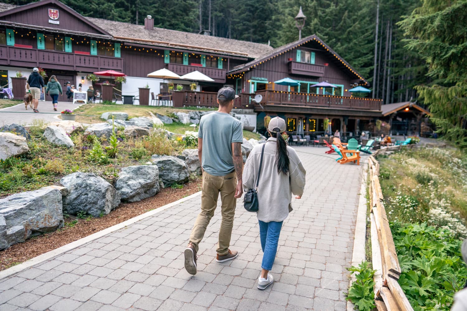
Walking through the arches of the resort and into the cellar of the restaurant, I found myself the only patron at the Snorting Elk bar.
It’s hard to overstate the importance of “The Elk” to the ski scene at Crystal Mountain. It has been the go-to Après Ski spot for a beer and some snacks for multiple generations. When the lifts close, you’ll walk into a shoulder-to-shoulder packed and dimly lit, underground, maybe 600 square feet room. It’s the kind of place that takes skill to make your way to the bar, all the while hearing stories about the day’s conditions. Capacity limits be damned, The Elk is just a couple hours from Seattle.
But that was in the dead of winter. Today it was just me and the bartender, Amos.

Like the Elk itself, it would be hard to overstate the importance of Amos to the ski scene at Crystal Mountain. At almost 40, it feels like he’s been behind the bar 7 days a week since he was as old as the teenagers that he now coaches. He’s the Ski Bum that ski bums point at and wish they could be.
Hamburger en route, and two beers later, Amos and I enjoyed trading stories in an uncharacteristically empty bar. I heard the same thing from Amos that I had heard from countless hikers, backcountry park rangers, and experienced townies: “Wait, you walked from Kennedy Meadows South through the Sierra in full snowpack”? It was fun to be able to talk to someone that understood the depth of that mission. Amos asked all of the questions that someone with decades of backcountry ski-mountaineering experience would ask, and we became fast friends.
When I departed to my room for the night, I left a fat tip. Yes, the service was obviously on point, but the tip was more because I respected his lifestyle and wanted to contribute to it.
Less than 15 hours after I walked into LOGE at Crystal Mountain, I was back on the PCT having slept in an actual bed (one of 4 total while I was on trail) showered, done my laundry, ate two meals and had a buncha beers in my belly.

I walked back up those few miles, regaining 1900 feet, and maybe it was the good night’s sleep, but you know what? They weren’t nearly as bad as I thought they would be. I found myself making a mental note to come back in the winter on a powder day. Maybe see Amos again and poke him to take me to the spots that only he knows. We were friends now, right?
I kept a good record of my time on the PCT. My notebook is part journal, part notes, and part map. Usually there are page-long notations of people, routes, water caches, animal encounters and just about any other thing of importance that you could imagine.
When my friend Slate invited me to submit an entry for the LOGE Journal, I went back to check my notes on these days and found just five words, but they perfectly captured the whole experience:
“The Hamburger was worth it”.

Join Our Family
By clicking send you'll receive occasional emails from LOGE. You always have the choice to unsubscribe within every email you receive.